Crowd sourced
We trust the wisdom of the crowd. The openrouteservice API consumes user-generated and collaboratively collected free geographic data, directly from OpenStreetMap.
Opensource
We believe in the benefit of open development, and so all code for openroutservice is opensource and freely available for all to download and contribute to on GitHub.
Humanitarian
We want to make life better and easier. Therefore, we constantly develop our services to meet current needs of people and search for new ways to engage in disaster prevention and relief.
Openrouteservice API services:
Directions
Openrouteservice’s directions can be used all around the globe. Consume rich route instructions in your applications for cars, trucks, different bike profiles, walking, hiking or wheelchair. Make use of plenty of options, ranging from different kinds of road restrictions to vehicle dimensions.
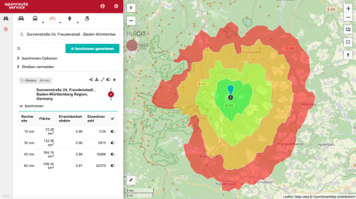
Isochrones
Reachability has become a crucial component for many organizations from all different kinds of domains. To this end, you can use openrouteservice to obtain isochrones which will help you determine which areas objects are able reach in given times or distances.
Time-Distance Matrix
Matrices allow you to compute many-to-many distances and the times of routes much faster than consuming the directions api over and over again. This application is frequently used by logistics organizations trying to figure out the most optimal route for deliveries.
Pelias Geocoding
Geocoding transforms a description of a location, such as a place name, street address or postal code, into a normalized description of the location with a point geometry. Our geocoding service is built on top of the sophisticated Pelias Stack which aggregates several data sources.
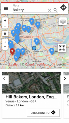
POIs
Openpoiservice allows you to find places of interest around or within given geographic coordinates. You can search for categories of points of interest around a point, path or even within a given polygon and consume the rich meta information returned by the api for your needs.
Elevation
Use our Openelevationservice to easily enrich your 2D geometries with height information based on SRTM data. Pass Point or Line geometries in different formats and recieve the 3 dimensional version back within milliseconds in your preferred format.
Optimization
Traveling Salesmen and other Vehicle Routing Problems are no problem for our optimization endpoint. Based on the excellent Vroom project this service provides you with optimal routes while considering your specific vehicle and time constraints.
Openrouteservice planning tools:
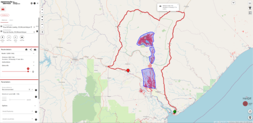
Disaster maps client
Based on the classic version, our client for disaster management is developed to support the work of humanitarian actors and disaster responders in the most vulnerable and disaster prone regions of the world. Thanks to the work of the Humanitarian OpenStreetMap Team and the Missing Maps project, in disaster situations the OSM data is continually updated and enriched with critical information. By limiting the service to active disaster regions, it is possible to recalculated the routing graph once every hour on basis of the most current OSM data.
New maps client
Our new maps client was built with the awesome VueJs framework is already available. The new client keeps all functionalities of the previous one, but is completely responsive and optimized for usage on both mobile and desktop browsers, while brings a bunch of new features. We are aiming for a more intuitive map interface that makes route planning even easier and are putting a lot of thought in structural and performance enhancements.
Help us to improve your user experience by providing us with feedback via our ask forum.
The source code is available for everybody on GitHub. A big advantage of the new approach is the possibility to convert the client to a native mobile app with ease, which brings us closer to offering an actual live routing app. So stay tuned for future developments!
Classic maps client
Our classic route planning tool enables you to use most of the openrouteservice API with only a few clicks on a map. Choose from a variety of profiles and set up to 50 waypoints to plan your route. Customize it by avoiding areas, specific street types or whole countries. Query POIs along your route, perform accessibility analyses for multiple points or simply inspect locations.
These and many more amazing features are offered free of charge and in different languages. But the best thing about this: It’s open source, so with a little bit of JavaScript knowledge you can easily adjust the client to your personal use case.